For Secondary School students
These resources teach Secondary students the importance of pedestrian, bicycle, and driver safety and provide opportunities to practice safe walking, cycling, and driving behaviours.
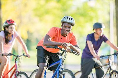
Active Transportation StoryMap module
Exploring active transportation in Peel Region
The school Active Transportation module uses an ArcGIS Online StoryMap application to enhance learning. This includes an introductory element of Geographic Information Systems (GIS) to make the learning new and exciting.
Educators can adapt this module for multiple subject areas in Grades 9 to 12.
This module will take 40 minutes to complete. Preparation requires access to a computer lab or a class set of laptops or tablets.
Access our teacher handbook for additional information on the module including curriculum connections.
After completing this module, students will be able to:
- Define active transportation
- Learn about Vision Zero
- Explore routes in their neighbourhood
- Map their route to school
- Learn about behaviours that make travelling on Peel roads safer
- Learn how active transportation promotes a healthy lifestyle and healthy environment
Start the Active Transportation module
Peel Vision Zero Road Safety
Vision Zero: Safer Roads in Peel Video
- Refer to this short video about making Peel's roads safer for pedestrians, cyclists, and drivers.
- Learn more about the Peel Region's Vision Zero strategy
Additional resources
The 10 Step Handbook for High School Bike Projects
Get more students and staff cycling with these 10 steps
Walking and cycling guides
Access guides and other resources to help you feel secure and confident in encouraging students and staff to use active transportation during their commute to school.
CAA's New Road User Lesson Plans
Teach road user safety with these interactive and curriculum-approved resources for secondary school students.